Silver Lake Project
Autumn, 2004 Campaign
Don Stierman is responsible for this page. Drs. Tim Fisher, Dave Krantz
and Harry Jol did the real work.
Updated 10/27/2004
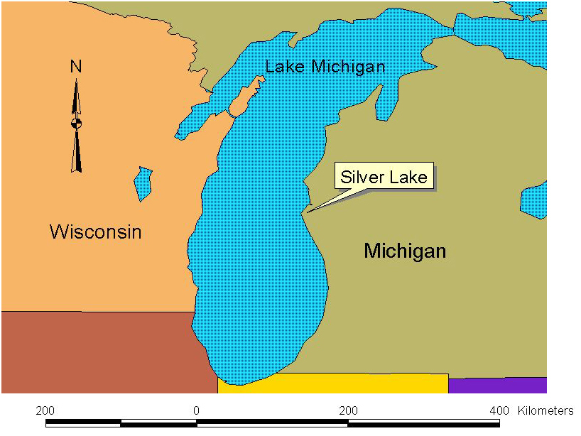
Tim Fisher is curious about changes in Lake Michigan since the glaciers last began to melt. A record of some lake level changes might be preserved in small lakes near Lake Michigan, records that energetic waves have erased from larger bodies of water. Silver Lake (Figure 1) is one such lake.
Figure 1: Location of Silver Lake, near the eastern shore of Lake Michigan.
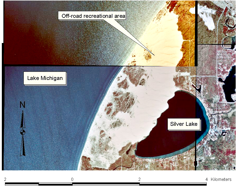
Figure 2: Active sand dunes separate Silver Lake from Lake Michigan. These aerial photos were obtained from the Michigan Center for Geographic Information. The northern third of this dune field is heavily exploited by off-road vehicle enthusiasts. Those who live near Silver Lake are concerned that migrating dunes could fill in the small lake.
Between Sept. 17 and Sept. 20 (inclusive) of 2004, students enrolled in Glacial
Stratigraphy and Geophysics were joined by their instructors, along with Dr.
Harry Jol from The University of Wisconsin Eau Clair and Dr. Walt Loope of the
USGS, to use geophysical methods for imaging structures concealed by sand
between Silver Lake and Lake Michigan (Figure 2). Also, cores were
collected from the bottom of Silver Lake, and geophysical surveys were attempted
on Silver Lake. Survey profile locations are shown in Figure 3.
Figure 4 and 5 show field teams conducting geophysical surveys. Figure 6
shows results.
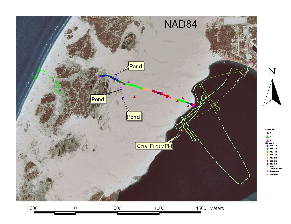
Figure 3: GPS locations for survey locations were supplemented with a total station survey to obtain elevation control needed to process geophysical measurements. The continuous line of multi-colored dots (color indicates elevation range) shows the location of the long ground-penetrating radar (GPR) profile.
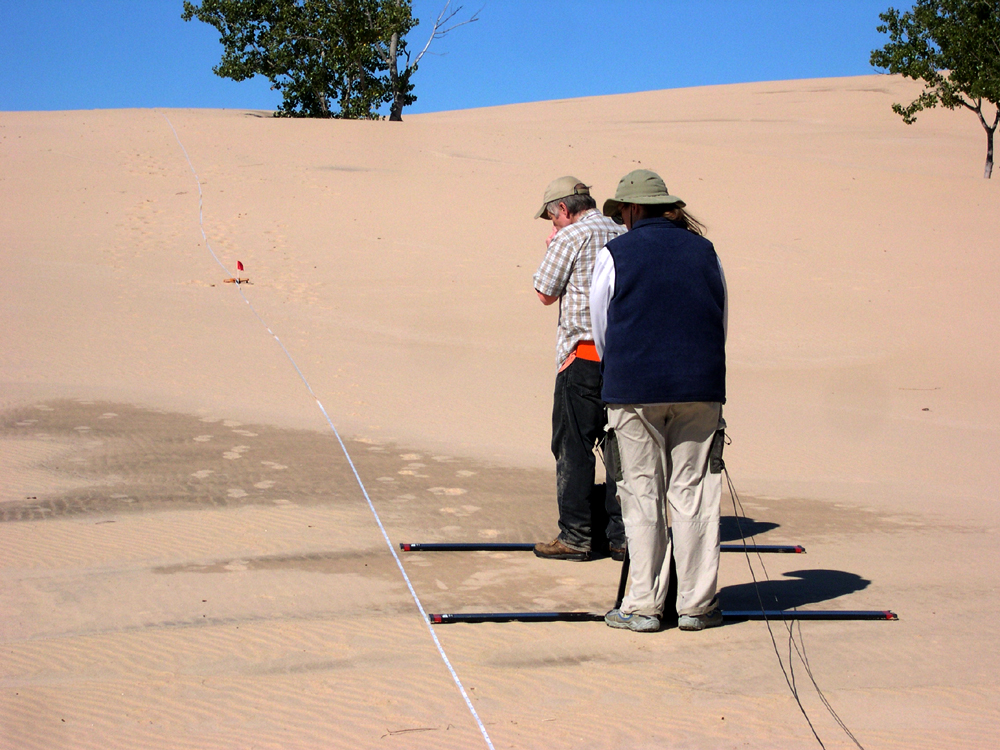
Figure 4: Walt and Amber ascend the dune field with GPR.
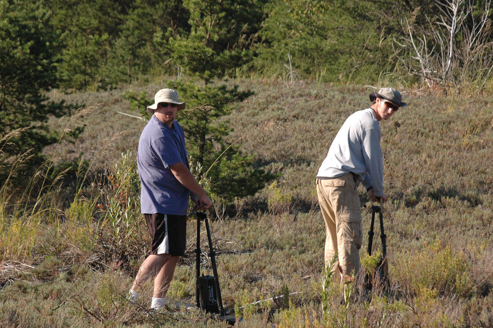
Figure 5: Bruce and Henry near the west end of the GPR profile. Vegetation (grass and trees) that covers sand in these low areas is clearly visible on the aerial photos.
![]()
Figure 6: GPR section adjusted for elevation along the profile delineated in Figure 3. Great data! Attempts to collect GPR readings from antennae floating on Silver Lake were far less successful. Go ahead - click the thumbnail, it is much larger than it appears. If your browser zooms so as to display the entire width of this image, right click and 'save as' so you can view it's glorious details with your favorite image processing software.
While students, instructors and visiting volunteers collected data on dry land, cores were collected from the deck of a pontoon boat on Silver Lake. Figures 7 and 8 document one collecting attempt.
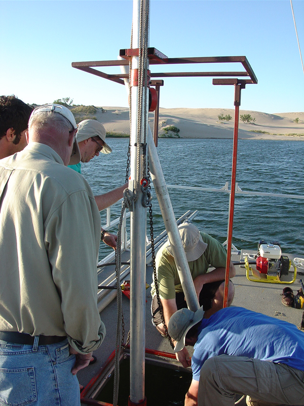
Figure 7: Workers intent on winching the core from the bottom of Silver Lake are too busy to smile for the camera.
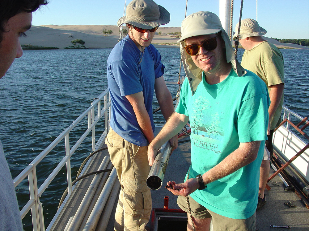
Figure 8. Success! Dr. Fisher displays some peat from sediments under Silver Lake, peat that formed from vegetation that grew in wetlands, not in a lake (perhaps like trees seen in Figure 5?).